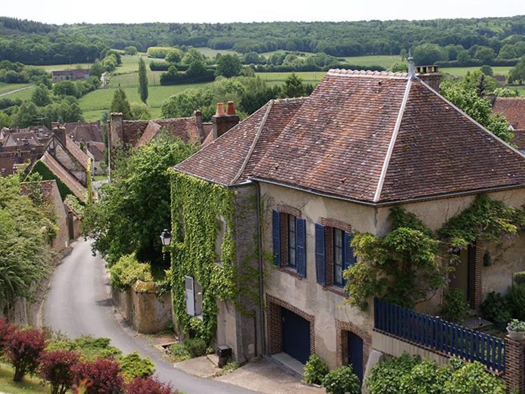
Culoiseau Ford
Explore a village full of character and a farming area composed of grasslands, woods and lakes.
Signage
- > Jaune
Particular difficulties
- Ford in 2 Respect the instructions during the crossing of the Culoiseau domain between 2 and 3 (do not shout, do not stray from the route and keep dogs on a leash) Crossing the D918
Useful information
- Departs from: MOUTIERS-AU-PERCHE
- Arrives at: MOUTIERS-AU-PERCHE
- Negative elevation gain: -143 m
- Positive elevation gain: 143 m
- Car park: Parking de l'église de Moutiers au Perche
To do nearby
- Nocé : Le Manoir de Courboyer (maison du Parc naturel Régional du Perche) Saint-Cyr-la-Rosière : Ecomusée du Perche (prieuré Ste-Gauburge)
To see on the route
- Moutiers-au-Perche : L'église Notre-Dame-du-Mont-Harou (XIIe - XVe) Site de Culoiseau
Route open to activities
Walking
- Difficulty: Easy
- Duration : 02 hours20
Stages
-
Stage 1 - N°1
At the Place de L’Église, take the path up the hillside into the forest. Bear right at the fork, cross over the avenue then turn left at the forest edge and descend the hill. At the fork continue right and carry on until you reach Culoiseau. Instructions to follow when crossing the estate: do not shout, do not stray from the itinerary even if the gate is open, keep dogs on a leash (a suckling cow can become aggressive if it is frightened).
Coordinates: 48.4786607, 0.84624611 Stage ID: 0000F1 -
Stage 2 - N°2
Cross the Ruisseau de la Feuillée stream. The path, clearly delineated by fences, weaves through the pastures. A shady and winding walk will take you to La Badinière. Pass through the hamlet and turn left onto the D618. Pass Chemin de La Baillière on your right and continue for 200 m.
Coordinates: 48.4865861, 0.85805362 Stage ID: 0000F2 -
Stage 3 - N°3
Turn left onto the path through the woods. At the crossroads, turn right. Cross to the right. Cross the D618 and, 250 m after a bungalow on your right, you will come to a crossing. Turn sharply to the left.
Coordinates: 48.49194, 0.84524 Stage ID: 0000F3 -
Stage 4 - N°4
Cross the D618 again and take the path to the right. Continue right, cross the D918 and take the path on the left down to a bridge over the Corbionne.
Coordinates: 48.4876208, 0.83888 Stage ID: 0000F4 -
Stage 5 - N°5
Turn left – do not cross the bridge. Cross the D918 (take care!) and continue ahead on the path which leads to the centre of Moutiers-au-Perche. Turn left and walk uphill towards the Church.
Coordinates: 48.47864, 0.8398 Stage ID: 0000F5
Who to contact?
-
e-mail
-


