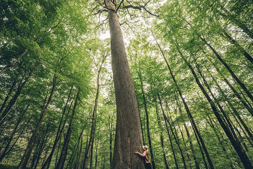
Le Chêne de l'Ecole Hike - Pays du Perche Ornais
Bellême Forest extends over the gentle Perche hills. Covered with majestic oak trees, a piece of ancient Gaul still lives on here.
Signage
- 1 à 5 - blanc - rouge 5 à 6 - jaune 6 à 7 - blanc - rouge 7 à 8 - jaune 8 à 9 - blanc - rouge 9 à 1 - jaune
Particular difficulties
- Hunting area (information from the ONF or the mairie).
Useful information
- Departs from: BELFORET-EN-PERCHE
- Arrives at: LA PERRIERE
- Negative elevation gain: -203 m
- Positive elevation gain: 203 m
- Car park: Place de la poste
To do nearby
- Montgaudry : Site de la butte
To see on the route
- Château de Montimer Chêne de l'école Site de l'Eperon
Route open to activities
Walking
- Difficulty: Medium
- Duration : 03 hours00
Stages
-
Stage 1 - N°1
Walk up Rue de la Grange.
Coordinates: 48.3901759, 0.44220426 Stage ID: 0000R1 -
Stage 2 - N°2
At the fork, turn right down Chemin de la Petite-Grange. Carry straight on for 400 m along the D210.
Coordinates: 48.3904538, 0.44254158 Stage ID: 0000R2 -
Stage 3 - N°3
Turn right onto the path at the end of Parcel 171.
Coordinates: 48.3936697, 0.45455050 Stage ID: 0000R3 -
Stage 4 - N°4
Turn right onto the forest track and continue to the Rond de Montimer.
Coordinates: 48.3941883, 0.46179684 Stage ID: 0000R4 -
Stage 5 - N°5
Follow Route Forestière La Perrière to the left for 800 m. Take the path to the right between Parcels 163 and 161 for 100 m, then to the left between Parcels 161 and 162. Continue straight on on Route Forestière du Chêne Saint-Louis. Fork right onto the path between Parcels 158 and 159.
Coordinates: 48.3916417, 0.46427015 Stage ID: 0000R5 -
Stage 6 - N°6
At the end, turn right onto the path between Parcels 159 and 160, then turn left. You will arrive at a small clearing. Turn right and continue on the path alongside the forest. At the kilns, continue on Route Forestière de la Haute-Fresnaye until you get to a junction. > The Chêne de l'École oak tree is on your right
Coordinates: 48.38269, 0.48538 Stage ID: 0000R6 -
Stage 7 - N°7
Continue straight on on Route Forestière de la Haute-Fresnaye for 500 m until you come out into a clearing. Take the winding sunken path on your left out of the forest towards Verger. Turn right onto the D644 (take care!), cross the D275 and follow the path ahead. Turn right onto the D210, heading uphill past Le Champu.
Coordinates: 48.3842599, 0.46449325 Stage ID: 0000R7 -
Stage 8 - N°8
At the start of a hairpin bend, turn left and walk down the hill. Cross the road and take Chemin de la Piponnerie ahead.
Coordinates: 48.3902955, 0.43599363 Stage ID: 0000R8 -
Stage 9 - N°9
After the Montperthuis stream, follow the path for 80 m and then turn right. Cross the stream again, walk up the bank and continue on the route. Return to your start point on Rue de La Grange.
Coordinates: 48.3953555, 0.43902848 Stage ID: 0000R9
Who to contact?
-
e-mail
-


