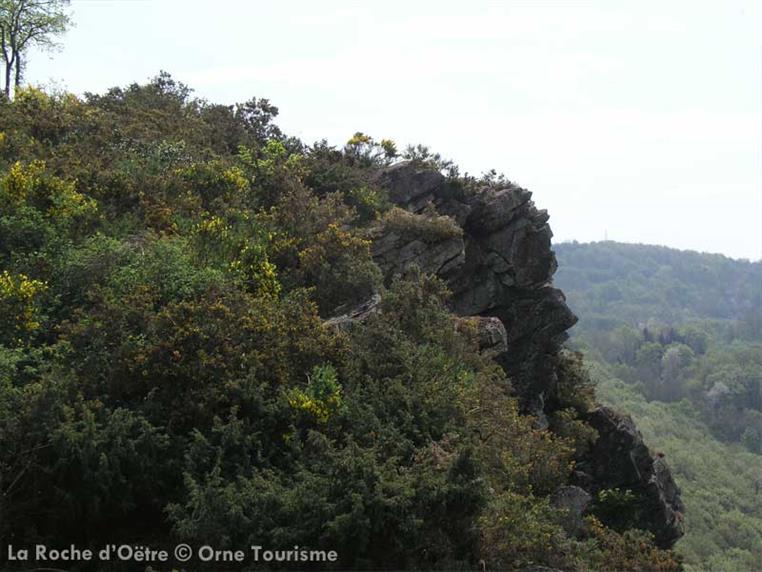
Botanical hike to the foot of the Rock of Oëtre – Suisse Normande
Swiss Normandy has a rich and varied flora, thanks to its well-preserved Bocage landscape. This botanical circuit celebrates this priceless natural heritage.
Signage
- Suivre les flèches jaunes : P. Bota (parcours botanique) 1 à 5 jaune 5 à 7 blanc - rouge 7 à 1 jaune
Particular difficulties
- There are difficult, and sometimes slippery, ascents and descents between stages 3 and 5. The route takes the D229 several times.
Useful information
- Departs from: ATHIS-VAL DE ROUVRE
- Arrives at: SEGRIE-FONTAINE
- Negative elevation gain: -200 m
- Positive elevation gain: 200 m
- Car park: Maison de la Rivière et du Paysage, à 500 m à l'Ouest du village par la D 224
To do nearby
- - Flers : château - Briouze : marais du grand-Hazé (espace naturel départemental et observatoire) - Lac de Rabodanges.
To see on the route
- - Maison de la Rivière et du Paysage (exposition) - Roche d'Oëtre (espace muséographique) - Parcours botanique.
Route open to activities
Walking
- Difficulty: Medium
- Duration : 03 hours00
Stages
-
Stage 1 - N°1
From the parking lot, take the path on the right and then turn right. At the crossroads, turn left and left again until you reach the D224. Take it on the right. Take the path on the left before the sign and the passage on the right leading to the church. Join the D229, follow it for 500 m.
Coordinates: 48.81209, -0.39814 Stage ID: 0000L1 -
Stage 2 - N°2
From here, it is possible to shorten the circuit by continuing on the road and then taking the small road to the right towards the "Pte Couture". Turn left on the path and then turn right to the road. Follow the description at 7. Otherwise, turn left along the wall. At the crossroads, turn right and at the calvary, left on the D329. At the Douit de Bréel, turn right on the path that goes up, continue straight ahead. Turn left before the houses and follow the path up.
Coordinates: 48.81267, -0.38799 Stage ID: 0000L2 -
Stage 3 - N°3
Continue to the left, cross the hamlet and take the path. Be careful with the slippery slope. Continue towards the path leading to Oëtre. At the entrance of the hamlet, take the path on the right until the crossing.
Coordinates: 48.81446, -0.37585 Stage ID: 0000L3 -
Stage 4 - N°4
From here, it is possible to take the off-road route to the Roche d'Oëtre. To do so, turn left to the D329. Follow it to the right and reach the Roche d'Oëtre. Be careful at the edge of the rocky escarpment. Otherwise, continue to the right and take the description from 4 b. 4 a - Departure from the Roche d'Oëtre. At the parking lot, go towards the belvedere and turn left along the ledges to the parking lot of the Parc acrobatique. Take the D329 on the right (GR 36) and take the path on the left. 4 b - Continue straight ahead. Leave the GR 36 by taking the Chenêt path on the right to join the D229.
Coordinates: 48.82351, -0.37175 Stage ID: 0000L4 -
Stage 5 - N°5
Take the road to the right until Souquet. Cross the hamlet and turn right towards La Bagotière.
Coordinates: 48.81663, -0.36314 Stage ID: 0000L5 -
Stage 6 - N°6
Take the path on the left before the house and turn right at the sign indicating the chapel of Blanc Rocher. Reach and pass the Hamel. Take the path on the left, at the end of the path turn left again until you reach the road.
Coordinates: 48.81274, -0.37499 Stage ID: 0000L6 -
Stage 7 - N°5
Cross the road and continue along the axis. At the crossroads, take the path on the left. Take the road on the left then turn right on the path leading to La Chevalerie. Take on the left (departure from Roche d'Oëtre or Bréel, continue on the right and take the description on the first page from "At the crossroads turn left").
Coordinates: 48.81117, -0.38592 Stage ID: 0000L7
Vidéo
Who to contact?
-
Web site (URL)


